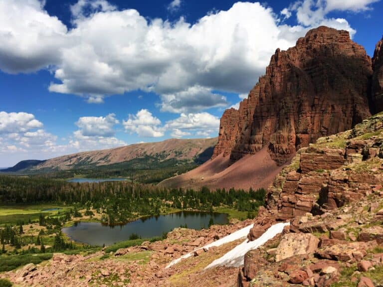
The Red Castle Lakes in the High Uintas Wilderness is one of the best backpacking trips in Utah. The Red Castle Lakes area is home to towering mountains and picturesque alpine lakes in the Uinta Mountain Range. Whether you’re an experienced outdoors person or want to explore a wild and vast landscape, this trip promises adventure with incredible vistas around every turn and plenty of wildlife encounters along the way.
At Lower Red Castle Lake, you’ll find comfortable camping spots and a tranquil lake perfect for morning fishing. Further up, you’ll explore high alpine lakes and big mountain passes that challenge your skills and test your resilience. The Red Castle area is my favorite spot in the Uintas. Backpacking Red Castle Lakes is a hike that is bucket list worthy.


Standard Route to Red Castle Lakes via China Meadows Trailhead
Trail Facts
- Trailhead: China Meadows Trailhead (most popular); other options below
- Primary Trail: East Fork Smiths Fork Trail
- Distance: 20.0 miles
- Days Needed: 2-4 Days
- Elevation Gain: 1,950 feet
- Difficulty: Moderate
- Best Time To Travel: Mid-June to Late September
Getting to the China Meadows Trailhead
The China Meadows Trailhead can be accessed by traveling down Red Castle Lakes Road in the Uintas. Beginning in Mountain View, Wyoming, head south on Wyoming State Highway 410 for about 4 miles. From there, WY-410 continues on your right, while 283 is straight.
Follow signs to the Stateline Campground and Marsh Lake Campground. You’ll see signage to the China Meadows Trailhead as you get closer. This is a forest service road, so expect dirt and bumps.
China Meadows has ample parking but does fill up. A parks pass, or a fee is required for day use and overnight parking at the trailhead. The China Meadows Campground fills up, but plenty of dispersed camping opportunities can be found nearby.
East Fork Smiths Fork Trail to Broadbent Meadow
The East Fork Smiths Fork Trail is a beautiful trail nestled within the Uinta Mountains, Utah’s only east-west running mountain range. The trail is suitable for all skill levels, including first-time backpackers. The trail begins by winding through old-growth forests before reaching a trail junction for Lake Hessie, roughly 4.2 miles into your hike.
Many hikers use Lake Hessie as a halfway spot, but I don’t recommend it. Visiting the lake will add another 4.5 miles roundtrip to your hike on top of a steep 800-foot uphill climb. If I get a late start, I like to use Broadbent Meadow, approximately 6.3 miles into your hike.
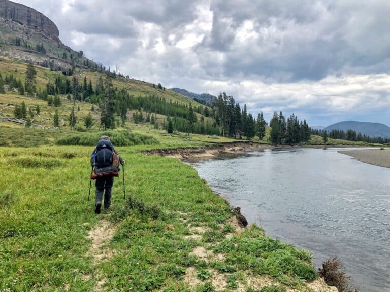
Broadbent Meadow is along the East Fork Smiths Fork River. Once you reach this point on the trail, you are afforded sweeping views of China Meadows – nature’s artwork at its finest. There are some open areas in the meadow where you can set up camp for the night if you want to break apart the 10-mile one-way hike to Lower Red Castle Lake.
Broadbent Meadow to Lower Red Castle Lake
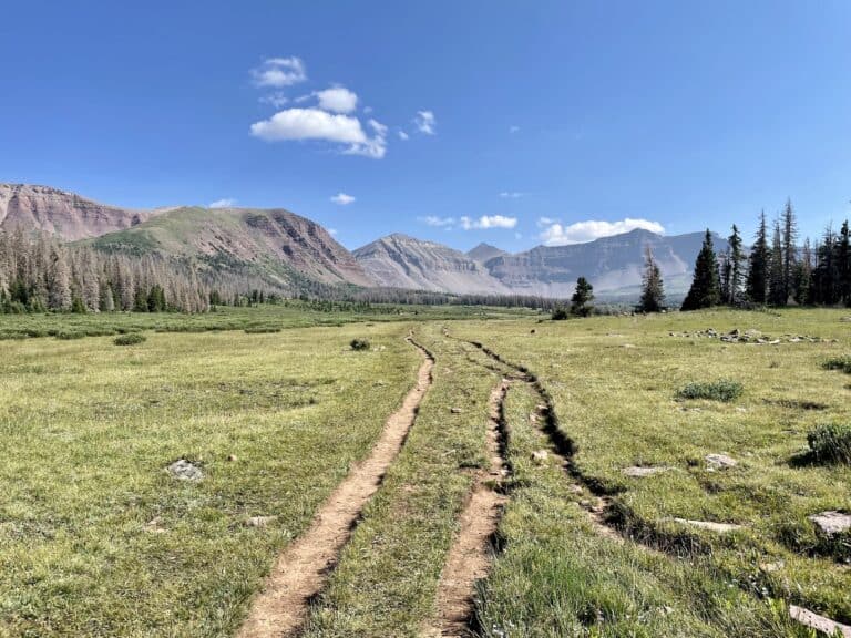
The hike from Broadbent Meadow to Lower Red Castle Lake is gently sloped, gaining only 600 feet of elevation over 3.7 miles. Red Castle dominates the landscape as you get closer to the lake.

If the sun is out and beaming onto Red Castle Peak at 12,680 feet, you’ll be awestruck by its vibrant red color. This color and the Red Castle’s shape create one of the most photographed spots in the High Uintas.
When you arrive at Lower Red Castle Lake, the East Fork Smiths Fork Trail takes you west of the lake and past several opportunities to make camp. This area is usually one of the first to fill up. Campsite opportunities exist in the grassy spots in front of the lake. This is my preferred spot because you can’t beat the view. There are also limited spots on the east side of the lake as well.
Several social trails will take you around Lower Red Castle Lake. On a sunny day, several anglers fish off the lake’s shore. The lower lake is stocked but feels overfished. I don’t see the type of fast fishing you find elsewhere in the Uintas at Lower Red Castle.
Day Hikes to Red Castle Lake and Upper Red Castle Lake
Once you’ve established camp, it’s time to explore. Depending on what time you arrive at Lower Red Castle Lake and how ambitious your exploration plans will determine your itinerary.
The most common objective is Red Castle Lake, a 600-foot climb a little under 2 miles from camp. To reach Red Castle Lake, continue on the East Fork Smiths Fork Trail on the west side of Lower Red Castle Lake. The trail will take you above the tree line, past a waterfall, and provide views into the Smiths Fork drainage.
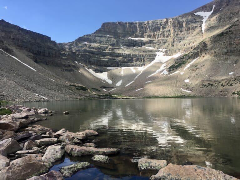
Red Castle Lake is massive, covering over 168 acres. It lies in a steep-walled cirque in the shadow of Wilson Peak. This geology makes Red Castle Lake one of the deepest in the High Uintas, with a 103-foot maximum depth. With its rocky, wide-open terrain and picturesque lake views, hikers seeking a peaceful camping getaway may find the surrounding area somewhat of a challenge as there are no nearby campsites.
Fishing at Red Castle Lake is one of the best experiences in the Uintas. The lake is stocked with cutthroat trout. Due to the size and depth, fish survive the winter freeze, yielding some of the biggest fish in the High Uintas. Spinners work wonders here.
The formal trail ends at the north shore of the lake, but it is possible to find your way around the west side. There might be a few spots where your feet get wet. This route is needed to explore Upper Red Castle Lake and Onweep Pass. There is no trail, and a few minor cliff bands must be negotiated to reach both objectives.
Upper Red Castle Lake is situated in a rugged cirque basin above the tree line at 11,500 feet. The lake forms the headwaters of the Smiths Fork River. Upper Red Castle Lake is 25 acres, with a depth of 72 feet. Only a few miles away from busy Lower Red Castle Lake, the rugged terrain provides more solitude. The lake is stocked every few years but can be a bit stubborn. Upper Red Castle’s depth produces some large cutthroat like Red Castle Lake.
One final objective of the hearty trekker is to ascend to the top of Onweep Pass. This is the pass to the hikers right as you look into the cirque west of Wilson Peak. The pass is unmarked and unnamed on maps; Onweep Pass is a name from locals.
The area around Upper Red Castle Lake is also known for its large herds of mountain goats. The water from the upper lake, grasses, and protection of the cirque keep them returning year after year. Look up into the cliffs of Wilson Peak to try and spot them.

The hike to the pass isn’t challenging, but the number of small cliff bands to negotiate can be a pain. The views are worth it, and some of the best in the High Uintas. If you make it to the pass, you’ll be rewarded with a sweeping view of all three Red Castle lakes, Red Castle Peak, and an elevated view of the entire basin. The U-Shape of Red Castle Lake against Red Castle Peak jettisoning out of the mountain range is beautiful.
Afternoon thunderstorms are common in the High Uintas. Try to be off the pass and on the trail heading back to Lower Red Castle Lake before lunchtime.
Other Possible Itineraries to Visit the Red Castle Lakes
Bald Mountain Route
Start at the East Fork Blacks Fork Trailhead and head east on the North Slope Highline Trail to the Bald Mountain Trail. The Bald Mountain route takes you around the base of Bald Mountain and offers views into Bald Lake. This will look like a tempting camping option, but it’s not.

The trail meanders through the high country, and you are above the timberline for several miles along a flat plateau. Several camping options exist after you descend into the basin. This route is far less popular, a more scenic hike, and just as far in the distance.
- Trailhead: East Fork Blacks Fork
- Primary Trail: Bald Mountain Trail
- Distance: 19.8 miles
- Days Needed: 2-4 Days
- Total Elevation Gain: 4,200 feet (2,900 out, 1,300 return)
- Difficulty: Moderate
Henrys Fork Loop
There are several options for backpacking Red Castle Lakes from the Henrys Fork Trailhead. The shortest trail is 17 miles one-way, so I recommend making a longer loop and enjoying several areas in the High Uintas.
Start by heading south on the Henrys Fork Trail. At Elkhorn Crossing, go west on the North Slope Highline Trail. Near Bear Lake, you will intersect with the Henrys Fork Basin Trail.
You want to continue towards the right and climb towards Big Meadow. Continue left on the same trail at the trail junction with the Big Meadow. At this point, you will intersect Lake Hessie and the East Fork Blacks Fork Trail, where you can follow the trip report above to Lower Red Castle Lake.
To make the loop from Lower Red Castle Lake, your next objective is to climb over Smiths Fork Pass. The trail crosses with the Uinta Highline Trail on the other side of the pass. Follow the sign to Anderson Pass through the upper parts of the Yellowstone Creek drainage.
You can add on a Kings Peak summit bid from the top of Anderson Pass. Next is Gunsight Pass and then reconnecting with the Henrys Fork Trail.
- Trailhead: Henrys Fork
- Primary Trail: Henrys Fork Trail, Uinta Highline Trail, and others
- Distance: 40.1 miles
- Days Needed: 4-6 Days
- Elevation Gain: 6,800 feet (w/o Kings Peak)
- Difficulty: Moderate
- Best Time To Travel: Mid-June to Late September
East Fork Blacks Fork Loop
This option includes Dead Horse Lake, Dead Horse Pass, Red Knob Pass, and some off-trail hiking. I wrote a trail guide on the week-long backpacking trip to the Red Castle Lakes that you should read for more details. A summary is below:
- Trailhead: East Fork Blacks Fork
- Distance: 80 miles
- Elevation: 12,320 feet
- Day 0: Car camping at East Fork Blacks Fork to get an early start on the day
- Day 1: East Fork Blacks Fork over Red Knob Pass to Deadhorse Lake | 17.5 miles
- Day 2: Deadhorse Lake to Ledge Lake (set up camp) and loop part of the Jack and Jill around Lightning Lake | 15.5 miles
- Day 3: Ledge Lake to Cleveland Pass | 12 miles
- Day 4: Cleveland Pass to Onweep Basin before Porcupine Pass | 13.5 miles
- Day 5: Onweep Basin to Lower Red Castle Lake over an Onweep Pass | 11 miles
- Day 6: Lower Red Castle Lake to East Forks Black Fork to complete the loop | 11 miles
FAQs for Red Castle Lakes
How long is the hike to Red Castle Lake?
The hike to Red Castle is 10 miles each way.
How bad are the bugs?
Expect mosquitoes below the timberline until mid-August. Upper Red Castle is generally bug-free because of the constant wind.
Can you swim in Red Castle Lake?
Yes, swimming in Red Castle Lake is possible, but it’s a cold endeavor. Red Castle often holds ice through mid-June; its depth and location don’t warm it up too much.
How do you get to Red Castle Lake?
The easiest way to get to Red Castle Lake is by taking the 10-mile hike along the East Fork Smiths Fork Trail from the China Meadows Trailhead.
How deep is Red Castle Lake?
Red Castle Lake is 168 feet deep, making it one of the deepest lakes in the Uintas.
