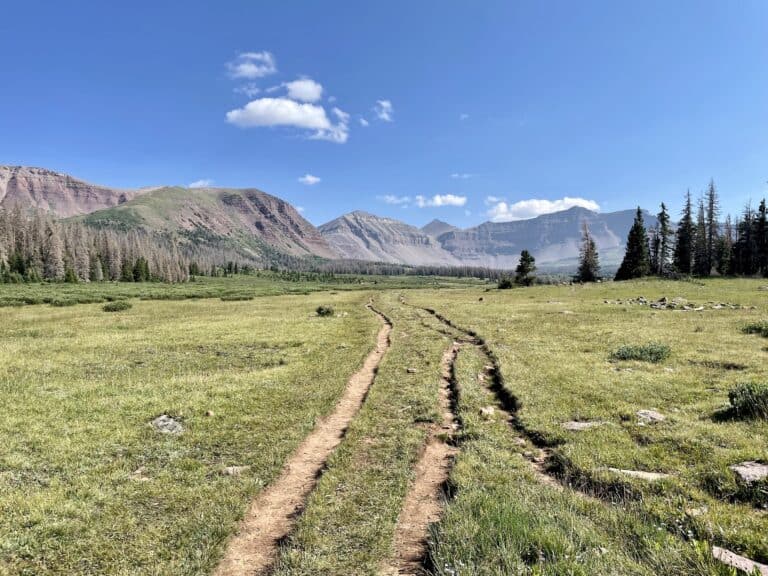
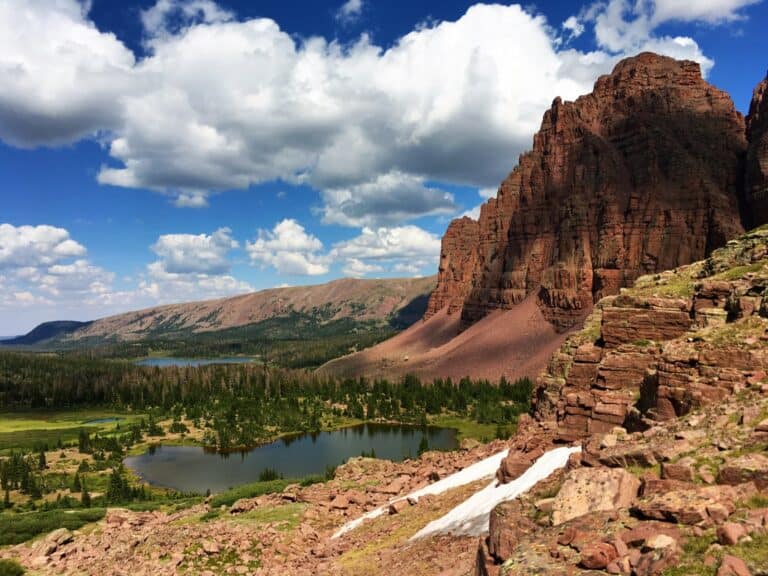
Located in northeastern Utah, the Uinta mountains are home to Utah’s tallest peaks. Contained within the Uinta mountain range is the High Uintas Wilderness area. Nearly all of the sub-mountain ranges in the lower 48 run north to south. The Uintas are unique because of their east-west orientation.
This protected area is home to at least 56 named peaks, including the state high point, Kings Peak. Much of the area is above the tree line, which creates a stunning backdrop in every direction.
There are over 2,000 lakes in the Uintas. There are also dozens of trailheads to start your adventures from. The Mirror Lake Highway is the only major road that receives heavy traffic in the winter. Solitude and the best hiking are found by those willing to drive a bit further from Salt Lake City and venture on some dirt roads to the more remote trailheads.
Many of the best places in the Uintas require extremely long trips on a trail network covering over 1700 miles. Day hikes are possible for reaching some of the best lakes in the Uinta mountains, but overnight backpacking trips often work best. Every Uintas lake on this list is best enjoyed as a multi-day backpacking trip.
Our list intentionally ignores some of the classic Uintas lakes located directly off Mirror Lake Highway. Mirror Lake, Wall Lake, Trial Lake, and Notch Lake are a few examples of this. Crowds, overuse, and the sounds of cars passing take away from the beauty. The best of the High Uintas Wilderness is found by using your legs and not a few hundred feet from a parking lot.
The list is in order of shortest hike to longest hike:
Henrys Fork Lake
Amethyst Lake
Naturalist Basin
Priord Lake
Dead Horse Lake
Lower Red Castle Lake
Henrys Fork Lake

At a Glance:
- Trailhead: Henrys fork trailhead
- Distance: 9.2 miles
- Elevation: 1,800 feet
Kings Peak, the highest point in Utah, is a common objective of many who visit the Uinta mountains. Due to its long approach, most Kings Peak hikers make it a multi-day backpacking trip. Henrys Fork Lake is the perfect place to establish a base camp for a Kings Peak summit attempt, spot moose on the regular, or enjoy the high country.
Two nearly equal-distance hiking trails will get you to Henrys Fork Lake. Both routes begin at the Henrys Fork Trailhead and continue to Elkhorn Junction. After reaching the Elkhorn Junction, the first option is to stay on the Henrys Fork Trail, continue past Dollar Lake, and then make a right onto the Henrys Fork Basin Trail. There is an obvious signpost that shows you where to make the turn. The second option is to turn right at Elkhorn Junction on the Henrys Fork Basin Trail and follow the trail past Bear Lake.
Once you’re at the lake, there are several places to establish a camp and enjoy the scenic views. High mountains surround the lake that moose visit daily. The combination of the two leads to Instagram-worthy pictures of your Uintas adventure. Like many lakes in the Uintas, Henrys Fork Lake is also regularly stocked and popular with anglers, so bring a fishing pole. There are many lakes in the basin that you can explore to test your luck.
Henrys Fork Lake offers a great view of the High Uinta mountains. The highest peaks surround you from all directions as several 13,000-foot peaks are visible. Gilbert Peak, Henrys Fork Peak, Kings Peak, Dome Peak, Mount Powell, and Gunsight Peak are all viable day hikes from where you are. To your west is Flat Top Mountain,
Henrys Fork Trail is a popular backpacking trail in the Uinta Mountains, and the parking area fills up. Henrys Fork Lake can be crowded, so arrive early to secure the best campsite.
Amethyst Lake

At a Glance:
- Trailhead: Christmas Meadows
- Distance: 13.0 miles
- Elevation: 2,620 feet
With a name like Amethyst Lake, you expect a vibrancy to the color of the water. Luckily, Amethyst Lake lives up to its name.
The hike up to Amethyst Lake begins at the Christmas Meadows. The trailhead is popular due to its proximity to the Mirror Lake Highway and shared trail access to Middle Basin. The early miles are relatively shaded as pine trees surround you. After passing the trail junction for Middle Basin and Ryder Lake, the trail climbs steeply in classic Uintas fashion.
Before arriving at Amethyst Lake, the trail mellows out, winding past a few small lakes and into breathtaking meadows. Campsites are hard to come by near Amethyst Lake, and we recommend camping in the meadow area before the lake if you’re turning this into an overnight hike.
There is a social trail that will take you around the lake and is worth doing. The views from the opposite end, especially if you gain some elevation up the rocky slopes, are picture worthy. Amethyst Lake is also regularly stocked and great for fishing. Most anglers will fish where the trail dumps you off at the base of the lake. Walking around the lake, you can find several great spots for fast fishing.
Naturalist Basin

At a Glance:
- Trailhead: Highline Trail
- Distance: 14.6 miles
- Elevation: 1,950 feet
I’m cheating by picking a collection of high alpine lakes instead of an individual gem. Trailhead access to Naturalist Basin is the easiest on the list and is just an hour’s drive from Park City. I recommend starting at the Highline Trail, but you can also begin from Mirror Lake. Either way, your goal is to take the Highline Trail to the Naturalist Basin Trail.
There are two sides to the basin to pick from as you arrive at the basin. The trail to the west takes you to the Morat Lakes and Blue Lake. The trail to the east takes you to Jordan Lake, Shaler Lake, and Faxon Lake. About 1.4 miles of off-trail hiking connects east and west routes into a loop.
You can begin hiking to Naturalist Basin in early June when many other trails in the High Uintas Wilderness are still snow-covered or too muddy. That’s not to say the Highline Trail or lakes area will be cleared of snow, but rather that you might have a chance to navigate around it. My picture above is Blue Lake from late June, with snow present.
Shaler and Jordan Lake are the best places for overnight camping. If you are comfortable with route finding and bouldering, consider a climb of nearby Mount Agassiz northwest of Blue Lake.
Priord Lake
At a Glance:
- Trailhead: East Fork Bear River
- Distance: 18.0 miles
- Elevation: 2,800 feet
Priord Lake is one of those High Uintas lakes that is recognizable simply for its color. That deep shade of turquoise blue in the open high country with Uinta mountains as a backdrop makes Priord Lake a beautiful experience. If sunset photography is your jam, this is the High Uintas experience for you.
The journey begins at the East Fork Bear River Trailhead. The trail follows (checks notes) the right-hand fork of the east fork of the bear river. The hiking trails in this area are generally shaded and open up to the occasional meadow.
The trail splits around the 3.9-mile mark. The left-hand fork takes hikers up to Allsop Lake, while the right-hand fork continues to Priord and Norice Lakes. The trees begin to get smaller and disappear as you pass Norice Lake. The landscape gets more magnificent as the terrain opens up and reveals a sublime alpine lake. Once you arrive at Priord Lake, note the towering mountains surrounding you. Lamotte Peak, The Cathedral, and Yard Peak dominate the landscape.
Back the way you came, there is a saddle between The Cathedral and Yard Peak that is passable for those who like to venture off-trail and scramble. You can climb the saddle to get a birds-eye view of Allsop Lake or as a means to summit Yard Peak.
Dead Horse Lake
At a Glance:
- Trailhead: West Fork Blacks Fork
- Distance: 19.4 miles
- Elevation: 1,700 feet
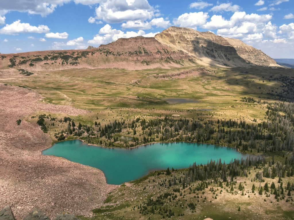
Dead Horse Lake is a stunning aqua-blue lake at the base of Dead Horse Pass. The lake is best viewed by partially (or fully) climbing up the pass. The view from Dead Horse Pass is one of the more unforgettable views for Highline Trail hikers, as the lake is the highlight of a beautiful view into the West Fork Blacks Fork basin.
The hike begins at the West Fork Blacks Fork Trailhead. Access to the trailhead requires crossing a river with your vehicle. If the river is high or you don’t have a high-clearance vehicle, you should leave your car on the other side and hike the extra 1.5 miles each way. Getting a tow truck out into the Uinta Mountains will cost you a mortgage payment.
The trail to Dead Horse Lake is stunning and worthy of a hike all by itself. The gentle grade, winding river, surrounding high peaks, and open pastures add to the hike’s beauty. Early in the season, expect some boggy and muddy sections.
Dead Horse Lake isn’t popular, but you should expect to see one or two other parties there. There are several campsites to spread everyone out. The towering Uinta mountains against the lake’s color make for some magnificent photos. I recommend climbing to the top of Dead Horse Pass as part of your trip before returning to the trailhead.
Lower Red Castle Lake
At a Glance:
- Trailhead: China Meadows
- Distance: 20.0 miles
- Elevation: 1,950 feet
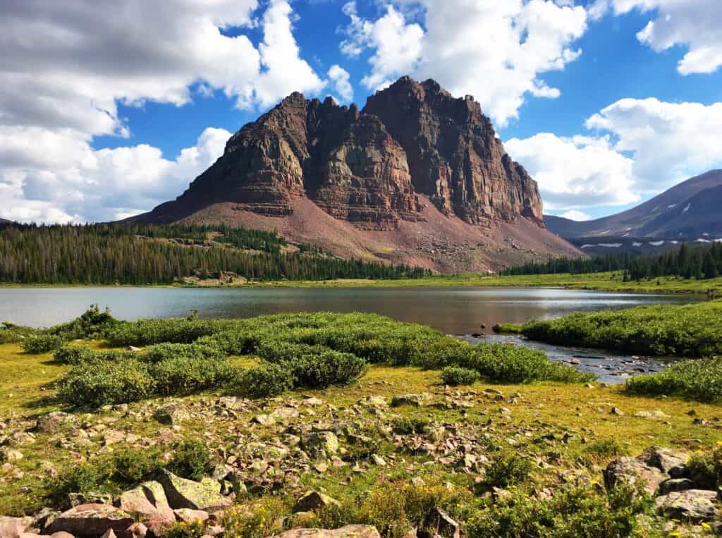
Lower Red Castle Lake is among the most popular hiking trails and backpacking destinations in the High Uintas Wilderness Area. The backdrop offered by Red Castle peak against Lower Red Castle Lake is a view that hikers will remember for the rest of their lives.
The China Meadows Trailhead offers ample parking but does fill up on the weekends. Outside of Kings Peak hikers camped at Dollar Lake in Henrys Fork Basin, you’d be hard-pressed to find a destination this popular.
Lower Red Castle Lake is a great base camp for anglers and day hikers. You can explore Red Castle Lake from your campsite, which is as magnificent as it is massive. Red Castle Lake is one of the deepest in the Uinta Mountains. Cutthroat trout live through the winter freeze and become huge. My biggest catches in the Uintas have come from Red Castle Lake.
Other day hikes include Kings Peak and Onweep Pass. Onweep Pass is off-trail but offers the best views of the upper red castle area. Using the China Meadows Trailhead as a starting and ending point for a more extended Uintas backpacking trip is also possible. While it is possible to hike to Lower Red Castle Lake and back to your car in one day, it’s far better to hike and enjoy over several days.
